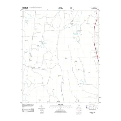
2011 Map of Villanow
USGS Topo · Published 2011About this map
Villanow and Reo anchor this corridor of Northwest Georgia, where the terrain transitions into a complex series of ridges and coves. The landscape is defined by its deep gaps and family-named landmarks, such as Snake Creek Gap and Gentry Gap, which historically dictated movement through the mountains. To the east, the heights of Dug Mountain and Hurricane Mountain flank the fertile Hurricane Valley, while the southern reaches descend into Furnace Valley and Redwine Cove. Genealogists will find a significant distribution of burial grounds, including the Macedonia Cemetery, Strain Family Cemetery, and White Cemetery. This network of cemeteries and small valley settlements reflects a long-standing rural community structure centered around water sources like Mill Creek and East Armuchee Creek.
Find a feature on this map
65 named features on this map. Tap any name to fly to it.
Don’t see what you’re looking for? This feature index may not catch every label — zoom into the map to look around manually.
Map Details
Editions of this 2011 Villanow Map
This is the sole edition of this map. No revisions or reprints were ever made.
Other maps of this area

1886 · Dalton
USGS Topo · 1:125,000

1886 · Ringgold
USGS Topo · 1:125,000

1892 · Ringgold
USGS Topo · 1:125,000

1892 · Dalton
USGS Topo · 1:125,000

1897 · Dalton
USGS Topo · 1:125,000

1935 · Catlett
USGS Topo · 1:24,000

1935 · Villanow
USGS Topo · 1:24,000

1935 · Nickajack Gap
USGS Topo · 1:24,000

1935 · Tunnel Hill
USGS Topo · 1:24,000

1938 · Chatsworth
USGS Topo · 1:48,000