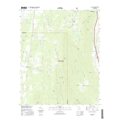
2017 Map of Villanow
USGS Topo · Published 2017About this map
Chattahoochee National Forest spans the central corridor of this Georgia landscape, defining the transition between the agricultural flats and the ridges of the Ridge and Valley province. Small settlements like Reo and Mill Creek serve as anchors along the valley floors, while the eastern edge is dominated by significant relief including Dug Mtn, Rocky Face Mtn, and Hurricane Mtn. The map provides excellent detail for genealogists, documenting numerous small family and community burial grounds such as the Strain Family Cem and Macedonia Cem. The presence of Snake Creek Gap and Gentry Gap highlights the vital natural passages through the terrain that have historically dictated transport routes, such as Lafayette Rd and the path toward Dalton.
Find a feature on this map
91 named features on this map. Tap any name to fly to it.
Don’t see what you’re looking for? This feature index may not catch every label — zoom into the map to look around manually.
Map Details
Editions of this 2017 Villanow Map
This is the sole edition of this map. No revisions or reprints were ever made.
Other maps of this area

1886 · Dalton
USGS Topo · 1:125,000

1886 · Ringgold
USGS Topo · 1:125,000

1892 · Ringgold
USGS Topo · 1:125,000

1892 · Dalton
USGS Topo · 1:125,000

1897 · Dalton
USGS Topo · 1:125,000

1935 · Catlett
USGS Topo · 1:24,000

1935 · Villanow
USGS Topo · 1:24,000

1935 · Nickajack Gap
USGS Topo · 1:24,000

1935 · Tunnel Hill
USGS Topo · 1:24,000

1938 · Chatsworth
USGS Topo · 1:48,000