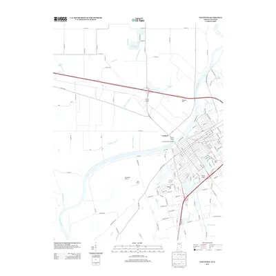
2013 Map of Vincennes
USGS Topo · Published 2013About this map
The Wabash River serves as the central artery for this border region, where the Lincoln Memorial Bridge connects the dense street grid of Vincennes to Westport across the state line. The landscape reflects a deeply engineered relationship with water, characterized by an extensive network of drainage features such as Allison Ditch, City Ditch, and Oliphant Ditch that carve through the Vincennes Prairie. These agricultural and civil improvements stand in contrast to the natural depressions of Beaver Pond and Otter Pond.
Find a feature on this map
139 named features on this map. Tap any name to fly to it.
Don’t see what you’re looking for? This feature index may not catch every label — zoom into the map to look around manually.
Map Details
Editions of this 2013 Vincennes Map
This is the sole edition of this map. No revisions or reprints were ever made.
Other maps of this area

1915 · Vincennes
USGS Topo · 1:62,500

1917 · Birds
USGS Topo · 1:62,500

1942 · Fritchton
USGS Topo · 1:24,000

1942 · Birds
USGS Topo · 1:62,500

1943 · Oaktown
USGS Topo · 1:24,000

1944 · Fritchton
USGS Topo · 1:24,000

1944 · Iona
USGS Topo · 1:24,000

1944 · Vincennes
USGS Topo · 1:62,500

1956 · Vincennes
USGS Topo · 1:250,000

1957 · Vincennes
USGS Topo · 1:250,000