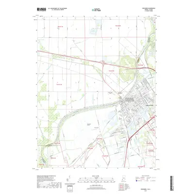
2019 Map of Vincennes
USGS Topo · Published 2019About this map
Vincennes sits at a historic bend of the Wabash River, where the border between Indiana and Illinois is defined by the water's edge. This 2019 survey captures the city's dense layout of civic and religious landmarks, most notably the George Rogers Clark National Historical Park and the sprawling campus of Vincennes University. The urban landscape is marked by a significant concentration of memorial sites, including the Old Cathedral Cem and B'nai Israel Cem, reflecting a long history of diverse communities in this river crossing.
Find a feature on this map
177 named features on this map. Tap any name to fly to it.
Don’t see what you’re looking for? This feature index may not catch every label — zoom into the map to look around manually.
Map Details
Editions of this 2019 Vincennes Map
This is the sole edition of this map. No revisions or reprints were ever made.
Other maps of this area

1915 · Vincennes
USGS Topo · 1:62,500

1917 · Birds
USGS Topo · 1:62,500

1942 · Fritchton
USGS Topo · 1:24,000

1942 · Birds
USGS Topo · 1:62,500

1943 · Oaktown
USGS Topo · 1:24,000

1944 · Fritchton
USGS Topo · 1:24,000

1944 · Iona
USGS Topo · 1:24,000

1944 · Vincennes
USGS Topo · 1:62,500

1956 · Vincennes
USGS Topo · 1:250,000

1957 · Vincennes
USGS Topo · 1:250,000