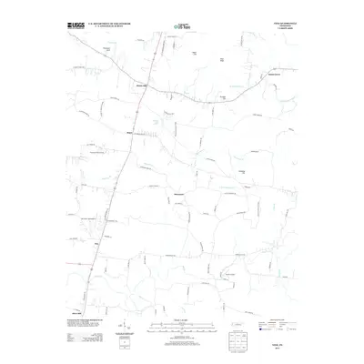
2013 Map of Vine
USGS Topo · Published 2013About this map
Bairds Mill and the surrounding rural landscape of Wilson County define this 2013 survey. The terrain is characterized by a series of prominent elevations, including Egypt Hill, Pilot Knob, and Pultight Hill, which overlook a network of winding waterways such as Hurricane Cr and Fall Cr. The area’s aviation history is visible through scattered small airstrips, notably Flatwood Field Airport and Fall Creek Field Airport. A significant portion of the landscape is occupied by the Cedars of Lebanon St Park, with several named roads like Cedar Forest Rd and Old Murfreesboro Rd tracing historical transit routes through the timbered sections. Settled pockets like Major and Adams Grove are connected by a web of local lanes and trails, including Burnt House Rd and Laura Thompson Trl, reflecting the deep-rooted community layout of this Tennessee corridor.
Find a feature on this map
82 named features on this map. Tap any name to fly to it.
Don’t see what you’re looking for? This feature index may not catch every label — zoom into the map to look around manually.
Map Details
Editions of this 2013 Vine Map
This is the sole edition of this map. No revisions or reprints were ever made.
Other maps of this area

1908 · Woodbury
USGS Topo · 1:62,500

1916 · Murfreesboro
USGS Topo · 1:62,500

1942 · Statesville
USGS Topo · 1:100,000

1942 · Lebanon
USGS Topo · 1:100,000

1950 · Walterhill
USGS Topo · 1:24,000

1951 · Lebanon
USGS Topo · 1:24,000

1951 · Martha
USGS Topo · 1:24,000

1956 · Vine
USGS Topo · 1:24,000

1956 · Gladeville
USGS Topo · 1:24,000

1956 · Columbia
USGS Topo · 1:250,000