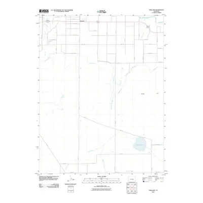
2010 Map of Vineland
USGS Topo · Published 2010About this map
The Vineland settlement sits at the heart of an intricate irrigation network in this 2010 survey of Pueblo County. The landscape is defined by the vital flow of the Arkansas River along the northern boundary and the Saint Charles River to the west, which together support an extensive system of man-made waterways. The presence of the Bessemer Ditch and the Huerfano Cucharas Ditch illustrates the region's reliance on managed water for agriculture and settlement. South of the main village, the terrain rises into the Badger Hills, while natural drainage is provided by Sixmile Creek and Fourmile Creek. In the southeast, Huerfano Lake serves as a significant hydrological landmark. The grid of named rural roads, such as Kalorama Pl, Hunsaker Rd, and McHarg Rd, reflects a pattern of family landholdings and rural development characteristic of this high plains agricultural corridor.
Find a feature on this map
39 named features on this map. Tap any name to fly to it.
Don’t see what you’re looking for? This feature index may not catch every label — zoom into the map to look around manually.
Map Details
Editions of this 2010 Vineland Map
This is the sole edition of this map. No revisions or reprints were ever made.
Other maps of this area

1891 · Pueblo
USGS Topo · 1:125,000

1891 · Nepesta
USGS Topo · 1:125,000

1893 · Nepesta
USGS Topo · 1:125,000

1894 · Pueblo
USGS Topo · 1:125,000

1896 · Pueblo
USGS Topo · 1:125,000

1897 · Pueblo
USGS Topo · 1:125,000

1904 · Nepesta
USGS Topo · 1:125,000

1954 · Pueblo
USGS Topo · 1:250,000

1957 · Pueblo
USGS Topo · 1:250,000

1958 · Pueblo
USGS Topo · 1:250,000