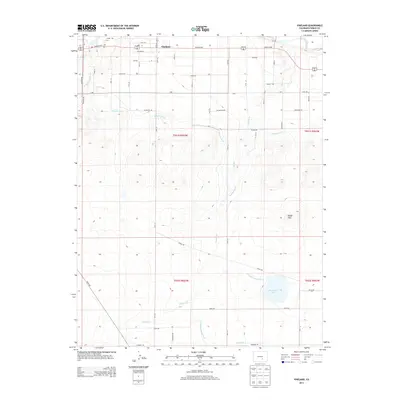
2013 Map of Vineland
USGS Topo · Published 2013About this map
Vineland serves as the primary settlement in this part of Pueblo County, where the high plains landscape is defined by an extensive network of irrigation infrastructure. This 2013 survey illustrates the complex water management systems essential for local agriculture, most notably the Bessemer Ditch and the Huerfano-Cucharas Ditch which cut across the terrain. To the south, the waters of Huerfano Lake provide a significant geographical anchor near the Badger Hills. The region's drainage is further defined by the Saint Charles River in the northwest and several smaller tributaries like Sixmile Cr and Fourmile Cr in the southern sections. This map provides a detailed view of the modern rural road grid, including Santa Fe Dr and Fields Rd, reflecting the continued development of the agricultural and residential corridors surrounding Pueblo.
Find a feature on this map
28 named features on this map. Tap any name to fly to it.
Don’t see what you’re looking for? This feature index may not catch every label — zoom into the map to look around manually.
Map Details
Editions of this 2013 Vineland Map
This is the sole edition of this map. No revisions or reprints were ever made.
Other maps of this area

1891 · Pueblo
USGS Topo · 1:125,000

1891 · Nepesta
USGS Topo · 1:125,000

1893 · Nepesta
USGS Topo · 1:125,000

1894 · Pueblo
USGS Topo · 1:125,000

1896 · Pueblo
USGS Topo · 1:125,000

1897 · Pueblo
USGS Topo · 1:125,000

1904 · Nepesta
USGS Topo · 1:125,000

1954 · Pueblo
USGS Topo · 1:250,000

1957 · Pueblo
USGS Topo · 1:250,000

1958 · Pueblo
USGS Topo · 1:250,000