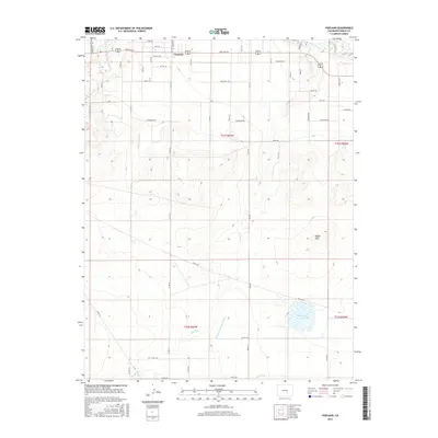
2016 Map of Vineland
USGS Topo · Published 2016About this map
Vineland serves as the primary settlement hub in this 2016 survey, situated just south of the Arkansas River in Pueblo County. The landscape is defined by its sophisticated water management systems, notably the Bessemer Ditch and the Huerfano Cucharas Ditch, which redirect water across the high plains to support local agriculture. This network of canals operates alongside natural watercourses like the Saint Charles River and Sixmile Cr. To the southeast, the topography rises toward the Badger Hills, while Huerfano Lake provides a significant catchment in the lower sections of the quadrangle. The grid-like road system, featuring family-named routes such as Hunsaker Rd and McHarg Rd, reflects the long-standing rural land divisions that have shaped this region's development between the river and the hills.
Find a feature on this map
54 named features on this map. Tap any name to fly to it.
Don’t see what you’re looking for? This feature index may not catch every label — zoom into the map to look around manually.
Map Details
Editions of this 2016 Vineland Map
This is the sole edition of this map. No revisions or reprints were ever made.
Other maps of this area

1891 · Pueblo
USGS Topo · 1:125,000

1891 · Nepesta
USGS Topo · 1:125,000

1893 · Nepesta
USGS Topo · 1:125,000

1894 · Pueblo
USGS Topo · 1:125,000

1896 · Pueblo
USGS Topo · 1:125,000

1897 · Pueblo
USGS Topo · 1:125,000

1904 · Nepesta
USGS Topo · 1:125,000

1954 · Pueblo
USGS Topo · 1:250,000

1957 · Pueblo
USGS Topo · 1:250,000

1958 · Pueblo
USGS Topo · 1:250,000