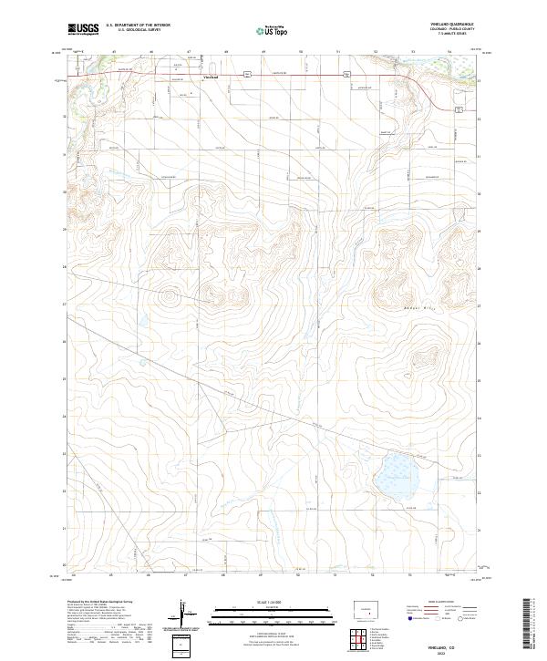
2022 Map of Vineland
USGS Topo · Published 2022About this map
Vineland sits at the northern edge of this high-plains landscape, where the agricultural legacy of Pueblo County is defined by an intricate network of irrigation and river drainage. The Arkansas River and Saint Charles River provide the primary water source for the region, managed through engineering works like the Bessemer Ditch and the Huerfano Cucharas Ditch. This system of water rights and management transformed the arid surroundings into a productive corridor of rural homesteads and farm roads, including Santa Fe Dr and Gale Rd. To the south, the terrain shifts into the rolling elevations of the Badger Hills, eventually giving way to the basin of Huerfano Lake. The map reveals a land structured by section lines and named rural routes like Nicholson Rd and Jersey Rd, illustrating how the valley's settlement patterns followed the reliable flow of the creeks and ditches.
Find a feature on this map
34 named features on this map. Tap any name to fly to it.
Don’t see what you’re looking for? This feature index may not catch every label — zoom into the map to look around manually.
Map Details
Editions of this 2022 Vineland Map
This is the sole edition of this map. No revisions or reprints were ever made.
Other maps of this area

1891 · Pueblo
USGS Topo · 1:125,000

1891 · Nepesta
USGS Topo · 1:125,000

1893 · Nepesta
USGS Topo · 1:125,000

1894 · Pueblo
USGS Topo · 1:125,000

1896 · Pueblo
USGS Topo · 1:125,000

1897 · Pueblo
USGS Topo · 1:125,000

1904 · Nepesta
USGS Topo · 1:125,000

1954 · Pueblo
USGS Topo · 1:250,000

1957 · Pueblo
USGS Topo · 1:250,000

1958 · Pueblo
USGS Topo · 1:250,000