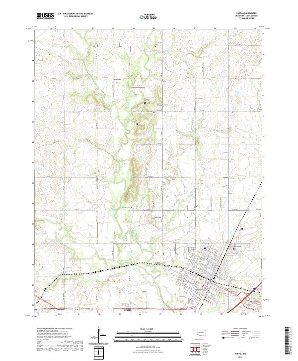
2022 Map of Vinita
USGS Topo · Published 2022About this map
Vinita serves as the focal point of this Craig County landscape, situated at the confluence of several regional transit corridors. The street grid of the town is detailed down to the Craig County Courthouse, surrounded by residential blocks and cemeteries that speak to the long-standing community roots in the area. To the north, the terrain transitions into a patchwork of rural section lines and agricultural allotments, shaped by the winding course of Big Cabin Creek and its many tributaries like Pecan Cr and Pawpaw Cr.
Find a feature on this map
96 named features on this map. Tap any name to fly to it.
Don’t see what you’re looking for? This feature index may not catch every label — zoom into the map to look around manually.
Map Details
Editions of this 2022 Vinita Map
This is the sole edition of this map. No revisions or reprints were ever made.
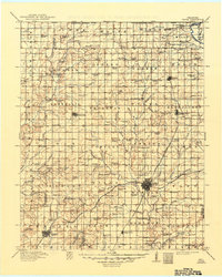
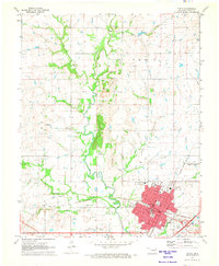
Historical Maps of Vinita Through Time
4 maps found