2024 Map of Viola
USGS Topo · Published 2024About this map
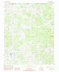
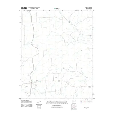
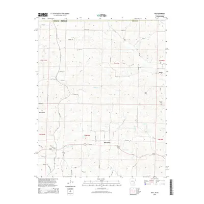
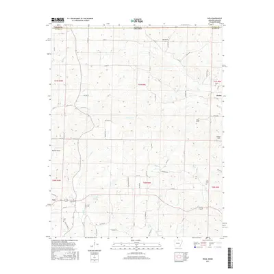
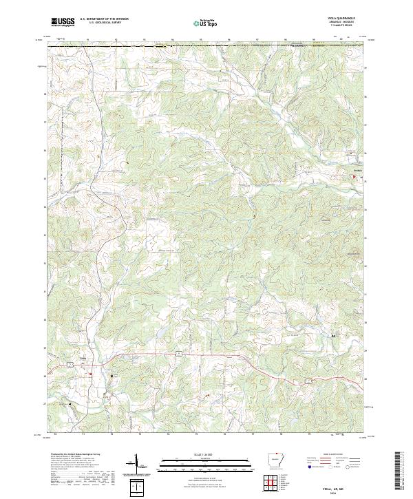
Viola and the smaller settlement of Sturkie anchor this section of Fulton County, Arkansas, just south of the Missouri state line. The landscape is defined by the sharp dissected drainage patterns of Bay Creek, Big Creek, and Trace Creek, which feed into larger systems like Davenport Creek to the south. Historically significant for genealogists, the map preserves the locations of several burial grounds, including Viola Cem, Watkins Cem, Barker Cem, and Gum Spring Cem. The terrain rises to notable high points such as Wildcat Knob and Shaw Knob in the east, while the west is characterized by hollows like Mashie Hollow. A network of local roads such as Browns Chapel Rd and Flint Springs Rd connects these rural communities, with Sparks Lake providing a prominent water feature near the primary settlement at Viola.
Find a feature on this map
74 named features on this map. Tap any name to fly to it.
Don’t see what you’re looking for? This feature index may not catch every label — zoom into the map to look around manually.
Map Details
Editions of this 2024 Viola Map
This is the sole edition of this map. No revisions or reprints were ever made.
Historical Maps of Viola Through Time
6 maps found