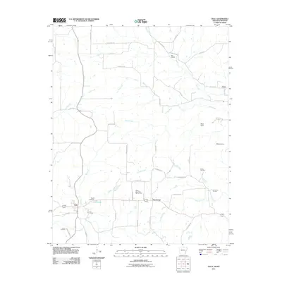
2011 Map of Viola
USGS Topo · Published 2011About this map
The town of Viola serves as a central hub in this Ozark landscape, situated where local routes like Hickory St and Oak St meet the broader transit corridors of north-central Arkansas. The area is defined by a complex network of waterways, with Big Creek and Trace Creek carving through the terrain alongside numerous branches and creeks. Agricultural and residential life is anchored by significant local landmarks, including several water management structures such as Sparks Lake Dam and James Lake Dam Number One. For genealogists, the map preserves the locations of multiple historic burial grounds, from the Viola Cemetery near the town center to the more outlying Gum Spring Cemetery, Barker Cemetery, and Watkins Cemetery. Notable elevations like Wildcat Knob and Shaw Knob rise above the drainage basins of Pine Hill Creek and Davenport Creek, illustrating the local topography near the community of Flint Springs.
Find a feature on this map
50 named features on this map. Tap any name to fly to it.
Don’t see what you’re looking for? This feature index may not catch every label — zoom into the map to look around manually.
Map Details
Editions of this 2011 Viola Map
This is the sole edition of this map. No revisions or reprints were ever made.
Other maps of this area

1890 · Mountain Home
USGS Topo · 1:125,000

1891 · Mountain Home
USGS Topo · 1:125,000

1894 · Mountain Home
USGS Topo · 1:125,000

1944 · West Plains
USGS Topo · 1:62,500

1944 · Cureall
USGS Topo · 1:62,500

1945 · Harrison
USGS Topo · 1:250,000

1946 · West Plains
USGS Topo · 1:62,500

1946 · Cureall
USGS Topo · 1:62,500

1949 · Harrison
USGS Topo · 1:250,000

1950 · Salem
USGS Topo · 1:62,500