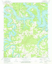
1974 Map of Viola
USGS Topo · Published 1977About this map
The rugged topography of the Ozarks is on full display here, dominated by the winding arms of Table Rock Lake and its confluence with the Kings River. This mid-1970s landscape shows a transition toward outdoor recreation following the damming of the White River, evidenced by numerous public use areas and campgrounds like Shell Knob Campground. In spite of these modern developments, the map preserves older community markers such as the Viola Cem and Field Cem.
Find a feature on this map
41 named features on this map. Tap any name to fly to it.
Don’t see what you’re looking for? This feature index may not catch every label — zoom into the map to look around manually.
Map Details
Editions of this 1974 Viola Map
This is the sole edition of this map. No revisions or reprints were ever made.
Other maps of this area

1900 · Eureka Springs
USGS Topo · 1:125,000

1901 · Eureka Springs
USGS Topo · 1:125,000

1904 · Harrison
USGS Topo · 1:125,000

1905 · Harrison
USGS Topo · 1:125,000

1907 · Forsyth
USGS Topo · 1:125,000

1927 · Shell Knob
USGS Topo · 1:62,500

1945 · Harrison
USGS Topo · 1:250,000

1949 · Harrison
USGS Topo · 1:250,000

1950 · Shell Knob
USGS Topo · 1:62,500

1954 · Harrison
USGS Topo · 1:250,000