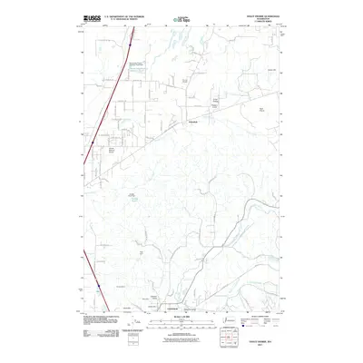
2011 Map of Violet Prairie
USGS Topo · Published 2011About this map
The Skookumchuck River and Hanaford Creek dominate the drainage of this landscape north of Centralia, where the terrain transitions from the lowlands of Hanaford Valley to the broad openings of Violet Prairie and Grand Mound Prairie. The area reflects a complex history of land use, from the small settlements of Sunnydale and Foran to the industrial legacy of the Monarch Mine, Stoker Mine, and Majestic Mine near Zenkner Valley. Small-scale aviation is represented by Sorrell Airport and Wissler's Airport, while water management is evidenced by multiple structures such as the Dunlap Pond Dam and Kyte Dam. This 2011 survey captures the region just as modern suburban development began pressing into traditional agricultural and mining lands, documented through a dense network of local roads like Tenino Grand Mound Rd SW and Big Hanaford Rd.
Find a feature on this map
44 named features on this map. Tap any name to fly to it.
Don’t see what you’re looking for? This feature index may not catch every label — zoom into the map to look around manually.
Map Details
Editions of this 2011 Violet Prairie Map
This is the sole edition of this map. No revisions or reprints were ever made.
Other maps of this area

1916 · Chehalis
USGS Topo · 1:125,000

1940 · Tenino
USGS Topo · 1:62,500

1941 · Meskill
USGS Topo · 1:62,500

1941 · Gate
USGS Topo · 1:62,500

1944 · Tenino
USGS Topo · 1:62,500

1949 · Tenino
USGS Topo · 1:62,500

1953 · Hoquiam
USGS Topo · 1:250,000

1953 · Rochester
USGS Topo · 1:62,500

1953 · Adna
USGS Topo · 1:62,500

1954 · Centralia
USGS Topo · 1:62,500