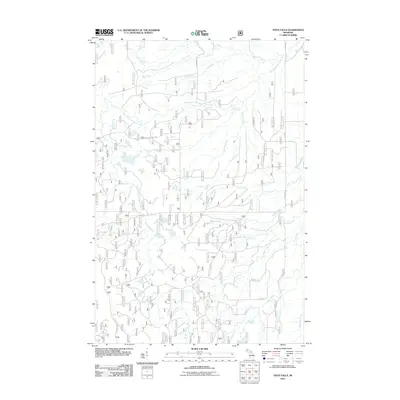
2011 Map of Vista Falls
USGS Topo · Published 2011About this map
The West Branch Sturgeon River dictates the landscape of this portion of Houghton County, carving a path where landmarks like Vista Falls and Hogger Falls emerge. This 2011 survey reveals an intricate network of forest roads, including Old Nat For Dev Rd 1500 and Nat For Dev Rd 1700, which provide access to a dense system of tributary streams. These waterways, with curious names such as Perjury Creek, Humbug Creek, and Wiggle Creek, suggest a complex local hydrology within the timbered tracts.
Find a feature on this map
28 named features on this map. Tap any name to fly to it.
Don’t see what you’re looking for? This feature index may not catch every label — zoom into the map to look around manually.
Map Details
Editions of this 2011 Vista Falls Map
This is the sole edition of this map. No revisions or reprints were ever made.
Other maps of this area

1954 · Rousseau
USGS Topo · 1:62,500

1954 · Pelkie
USGS Topo · 1:62,500

1954 · Winona
USGS Topo · 1:62,500

1954 · Sidnaw
USGS Topo · 1:62,500

1958 · Iron River
USGS Topo · 1:250,000

1960 · Iron River
USGS Topo · 1:250,000

1961 · Iron River
USGS Topo · 1:250,000

1967 · Iron River
USGS Topo · 1:250,000
1982 · Nisula
USGS Topo · 1:25,000
1982 · Sparrow Rapids
USGS Topo · 1:25,000