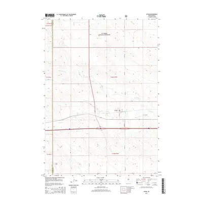
2015 Map of Vivian
USGS Topo · Published 2015About this map
The town of Vivian serves as a central hub in Lyman County, situated where the high plains terrain of the Ft. Pierre National Grassland meets the agricultural rhythms of central South Dakota. This 2015 survey details the local infrastructure, including the grid of Vivian itself with streets like Railway St and Main Ave, alongside the rural Vivian Cem located just east of the primary settlement. The landscape is defined by the drainage patterns of Medicine Cr and its northern tributary, N Fork Medicine Cr, which carve through the open grassland. Further south, the Oller Airport and a network of range-line roads like 293rd Ave and 243rd St illustrate the modern transportation and section-line survey patterns that organize this expanse of the Great Plains.
Find a feature on this map
24 named features on this map. Tap any name to fly to it.
Don’t see what you’re looking for? This feature index may not catch every label — zoom into the map to look around manually.
Map Details
Editions of this 2015 Vivian Map
This is the sole edition of this map. No revisions or reprints were ever made.
Other maps of this area

1954 · Pierre
USGS Topo · 1:250,000

1955 · Martin
USGS Topo · 1:250,000

1958 · Pierre
USGS Topo · 1:250,000

1958 · Martin
USGS Topo · 1:250,000

1967 · Ft. George Butte SW
USGS Topo · 1:24,000

1970 · Vivian SW
USGS Topo · 1:24,000

1972 · Pierre 3 SW
USGS Topo · 1:24,000

1972 · Pierre 3 SE
USGS Topo · 1:24,000

1972 · Vivian
USGS Topo · 1:24,000

1972 · Vivian SE
USGS Topo · 1:24,000