
1972 Map of Pierre 3 SE
USGS Topo · Published 1975About this map
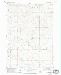
The Old Indian Treaty Boundary slices through the southern portion of this landscape, marking a significant historical line of demarcation across the Lyman and Jones county border. This 1972 survey focuses on a remote stretch of central South Dakota characterized by expansive terrain segments like Richland Valley and the prominent rising of Stony Butte. Drainage patterns for the area are defined by the winding course of Stony Butte Creek and the headwaters of Cedar Cr in the northeast corner. Settlement is sparse, with the map primarily documenting the natural relief and the cadastral divisions of Rowe, Hope, and other townships. The inclusion of the treaty boundary provides a rare look at the legacy of land agreements and surveying history in the West River region, serving as a permanent anchor on the landscape long after the original treaties were established.
Find a feature on this map
8 named features on this map. Tap any name to fly to it.
Don’t see what you’re looking for? This feature index may not catch every label — zoom into the map to look around manually.
Map Details
Editions of this 1972 Pierre 3 SE Map
2 editions found
Other maps of this area

1953 · Pierre 3 NW
USGS Topo · 1:24,000

1954 · Pierre
USGS Topo · 1:250,000

1955 · Martin
USGS Topo · 1:250,000

1958 · Pierre
USGS Topo · 1:250,000

1958 · Martin
USGS Topo · 1:250,000

1967 · Ft. George Butte NW
USGS Topo · 1:24,000

1967 · Ft. George Butte SW
USGS Topo · 1:24,000

1972 · Pierre 3 SW
USGS Topo · 1:24,000

1972 · Vivian
USGS Topo · 1:24,000
1972 · Pierre 3 NE
USGS Topo · 1:24,000