
1967 Map of Ft. George Butte SW
USGS Topo · Published 1969About this map
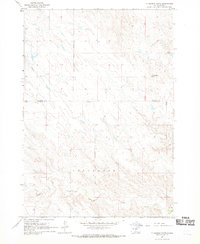
The Old Indian Treaty Boundary cuts through this portion of Lyman County, serving as a significant historical marker in the central South Dakota landscape. Surveyed in the mid-1960s, the terrain is defined by the drainage patterns of several seasonal watercourses, including the South Branch Cedar Creek in the north and the winding path of Nail Creek in the southeast. Large tracts of land are identified by names such as Mcclure, Tracy, and Lund, reflecting the regional landholding patterns of the era. The presence of Knudson Dam and various fence lines, captured through photogrammetric methods, highlights the agricultural infrastructure supporting local ranching operations. The confluence of Stony Butte Creek near the western edge illustrates the remote, watershed-focused nature of the geography during this period.
Find a feature on this map
11 named features on this map. Tap any name to fly to it.
Don’t see what you’re looking for? This feature index may not catch every label — zoom into the map to look around manually.
Map Details
Editions of this 1967 Ft. George Butte SW Map
This is the sole edition of this map. No revisions or reprints were ever made.
Other maps of this area

1954 · Pierre
USGS Topo · 1:250,000

1955 · Martin
USGS Topo · 1:250,000

1958 · Pierre
USGS Topo · 1:250,000

1958 · Martin
USGS Topo · 1:250,000

1966 · Ft. George Butte SE
USGS Topo · 1:24,000

1967 · Ft. George Butte NW
USGS Topo · 1:24,000
1967 · Ft. George Butte
USGS Topo · 1:24,000

1972 · Pierre 3 SE
USGS Topo · 1:24,000

1972 · Vivian
USGS Topo · 1:24,000
1972 · Pierre 3 NE
USGS Topo · 1:24,000