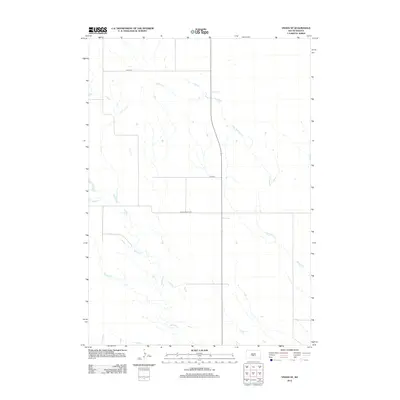
2012 Map of Vivian SE
USGS Topo · Published 2012About this map
Sedlano Cr and Williams Cr define the drainage patterns of this rural landscape in Jones County during the early 2010s. The area is marked by a sparse, grid-based transportation network typical of the Great Plains, where long stretches of unpaved roads like 244th St and 247th St connect isolated farmsteads and agricultural plots. The primary thoroughfare for local transit is Jones Co Hwy S9, which cuts across the central portion of the quadrangle. This survey illustrates a quiet prairie environment where the terrain is primarily shaped by the meandering paths of its seasonal creeks rather than dense human settlement or industrial infrastructure.
Find a feature on this map
5 named features on this map. Tap any name to fly to it.
Don’t see what you’re looking for? This feature index may not catch every label — zoom into the map to look around manually.
Map Details
Editions of this 2012 Vivian SE Map
This is the sole edition of this map. No revisions or reprints were ever made.
Other maps of this area

1951 · Badnation
USGS Topo · 1:24,000

1951 · Badnation NW
USGS Topo · 1:24,000

1951 · Presho 4 NW
USGS Topo · 1:24,000

1955 · Martin
USGS Topo · 1:250,000

1958 · Martin
USGS Topo · 1:250,000

1970 · Vivian SW
USGS Topo · 1:24,000

1972 · Vivian
USGS Topo · 1:24,000

1972 · Vivian SE
USGS Topo · 1:24,000
1972 · Vivian NW
USGS Topo · 1:24,000

1978 · Presho SW
USGS Topo · 1:24,000