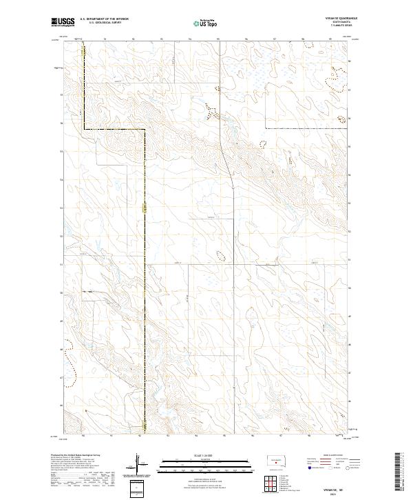
2021 Map of Vivian SE
USGS Topo · Published 2021About this map
Jones and Lyman counties meet along a jurisdictional boundary that bisects this prairie landscape, defined by the winding paths of Sedlano Creek and Williams Creek. The terrain is characterized by the intricate drainage patterns of these creeks as they carve through the South Dakota plains, creating a network of small wetlands and depressions. The human footprint is marked by the rigid Public Land Survey System grid, which dictates the placement of rural corridors such as 244th Street and 291st Avenue. Local travel is anchored by County Road 59, which connects the scattered agricultural sections. This map offers a clear view of the rural township structure, showing how the natural topography of the creek beds interacts with the deliberate section lines of the late twentieth and early twenty-first centuries.
Find a feature on this map
18 named features on this map. Tap any name to fly to it.
Don’t see what you’re looking for? This feature index may not catch every label — zoom into the map to look around manually.
Map Details
Editions of this 2021 Vivian SE Map
This is the sole edition of this map. No revisions or reprints were ever made.
Other maps of this area

1951 · Badnation
USGS Topo · 1:24,000

1951 · Badnation NW
USGS Topo · 1:24,000

1951 · Presho 4 NW
USGS Topo · 1:24,000

1955 · Martin
USGS Topo · 1:250,000

1958 · Martin
USGS Topo · 1:250,000

1970 · Vivian SW
USGS Topo · 1:24,000

1972 · Vivian
USGS Topo · 1:24,000

1972 · Vivian SE
USGS Topo · 1:24,000
1972 · Vivian NW
USGS Topo · 1:24,000

1978 · Presho SW
USGS Topo · 1:24,000