
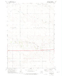
1970 Map of Vivian SW
USGS Topo · Published 1972About this map
Zickrick and Dunkel define the topography of this Jones County landscape as it appeared in the early 1970s. The region is characterized by a network of drainage patterns, most notably the wide course of Williams Creek which dominates the central portion of the quadrangle. Other water features including Squaw Creek and Bull Creek segment the terrain, while the presence of a Flowing Well and the Spillway Elev 1797 suggest the management of water resources in this prairie environment. The map provides a distinct look at the rural section lines and land divisions of the era, documented just before the 1972 field check. This survey is particularly useful for those tracking land use and natural water features in south-central South Dakota, offering a clear record of the physical geography before modern agricultural or infrastructure shifts.
Find a feature on this map
6 named features on this map. Tap any name to fly to it.
Don’t see what you’re looking for? This feature index may not catch every label — zoom into the map to look around manually.
Map Details
Editions of this 1970 Vivian SW Map
This is the sole edition of this map. No revisions or reprints were ever made.
Other maps of this area

1951 · Murdo SE
USGS Topo · 1:24,000

1951 · Badnation
USGS Topo · 1:24,000

1951 · White River NE
USGS Topo · 1:24,000

1951 · Badnation NW
USGS Topo · 1:24,000

1955 · Martin
USGS Topo · 1:250,000

1958 · Martin
USGS Topo · 1:250,000

1972 · Draper
USGS Topo · 1:24,000

1972 · Vivian
USGS Topo · 1:24,000

1972 · Vivian SE
USGS Topo · 1:24,000
1972 · Vivian NW
USGS Topo · 1:24,000