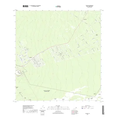
2017 Map of Volcano
USGS Topo · Published 2017About this map
Hawai'i Volcanoes National Park dominates the southern landscape of this survey, illustrating a terrain defined by active geologic history. The residential community of Volcano sits perched at the northern edge of the park boundary, with its grid of numbered streets like First St and Second St contrasting against the irregular volcanic features nearby. The map precisely documents the intersection of human settlement and eruptive events, specifically identifying the extent of various basaltic deposits including the Lava Flow of 1959 near Kīlauea Iki Crater and the later Lava Flow of 1972 along the Chain of Craters. To the northeast, the rural subdivisions of Glenwood and Fern Forest are reached by a network of local roads such as Wright Rd and Old Volcano Rd, showing the extent of modern development on the Island of Hawai'i.
Find a feature on this map
87 named features on this map. Tap any name to fly to it.
Don’t see what you’re looking for? This feature index may not catch every label — zoom into the map to look around manually.
Map Details
Editions of this 2017 Volcano Map
This is the sole edition of this map. No revisions or reprints were ever made.
Other maps of this area

1917 · Hilo
USGS Topo · 1:62,500

1921 · Kilauea
USGS Topo · 1:62,500

1922 · Puna
USGS Topo · 1:62,500

1924 · Kilauea
USGS Topo · 1:62,500

1924 · Puna
USGS Topo · 1:62,500

1930 · Humuula
USGS Topo · 1:62,500

1932 · Hilo
USGS Topo · 1:62,500

1954 · Hawaii South
USGS Topo · 1:250,000

1954 · Hawaii North
USGS Topo · 1:250,000
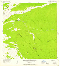
1956 · Kulani
USGS Topo · 1:24,000