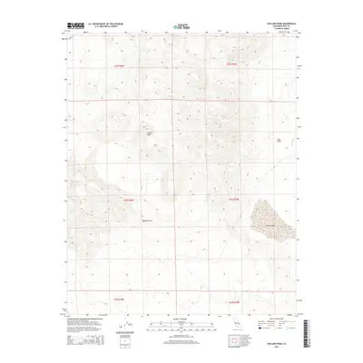
2015 Map of Volcano Peak
USGS Topo · Published 2015About this map
Volcano Peak rises as the central topographic landmark of this desert landscape, where the northern reaches of the Mojave Desert meet the distinct drainage patterns of the Coso Basin. The map captures a largely uninhabited expanse defined by its geological and hydrological features rather than human settlement. In the southeastern corner, the broad, flat expanse of Airport Lake sits near the drainage of Coso Wash, illustrating the seasonal water patterns common to this arid region. Aside from the presence of Cinder Rd in the extreme northwest, the area remains an open terrain of deep washes and high ridges, providing an essential record of the natural contours and township boundaries within Inyo County during the mid-2010s.
Find a feature on this map
12 named features on this map. Tap any name to fly to it.
Don’t see what you’re looking for? This feature index may not catch every label — zoom into the map to look around manually.
Map Details
Editions of this 2015 Volcano Peak Map
This is the sole edition of this map. No revisions or reprints were ever made.
Other maps of this area

1908 · Ballarat
USGS Topo · 1:250,000

1913 · Ballarat
USGS Topo · 1:250,000

1915 · Searles Lake
USGS Topo · 1:250,000

1947 · Trona
USGS Topo · 1:250,000

1948 · Trona
USGS Topo · 1:250,000

1948 · Death Valley
USGS Topo · 1:250,000

1951 · Haiwee Reservoir
USGS Topo · 1:62,500

1951 · Coso Peak
USGS Topo · 1:62,500

1953 · Mountain Springs Canyon
USGS Topo · 1:62,500

1953 · Trona
USGS Topo · 1:250,000