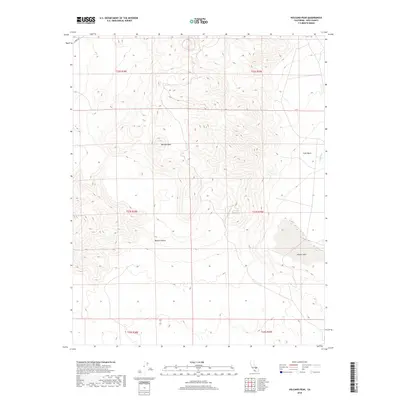
2018 Map of Volcano Peak
USGS Topo · Published 2018About this map
Volcano Peak rises as the central topographic focal point in this arid stretch of Inyo County, situated where the high desert terrain meets the northwestern reaches of the Mojave Desert. The map reveals a stark landscape of geological features and ephemeral water systems, most notably the dry expanse of Airport Lake in the southeastern corner. This area serves as a significant drainage point for the surrounding highlands, including the Coso Basin and the meandering Coso Wash that cuts through the eastern sections of the quadrangle. Human impact on the land is sparse, primarily represented by Cinder Rd in the north and the gridded surveying of township and range lines. The concentration of contour lines around the peak and the broad, flat reaches of the basin highlight the dramatic elevation shifts characteristic of the region’s volcanic geography.
Find a feature on this map
12 named features on this map. Tap any name to fly to it.
Don’t see what you’re looking for? This feature index may not catch every label — zoom into the map to look around manually.
Map Details
Editions of this 2018 Volcano Peak Map
This is the sole edition of this map. No revisions or reprints were ever made.
Other maps of this area

1908 · Ballarat
USGS Topo · 1:250,000

1913 · Ballarat
USGS Topo · 1:250,000

1915 · Searles Lake
USGS Topo · 1:250,000

1947 · Trona
USGS Topo · 1:250,000

1948 · Trona
USGS Topo · 1:250,000

1948 · Death Valley
USGS Topo · 1:250,000

1951 · Haiwee Reservoir
USGS Topo · 1:62,500

1951 · Coso Peak
USGS Topo · 1:62,500

1953 · Mountain Springs Canyon
USGS Topo · 1:62,500

1953 · Trona
USGS Topo · 1:250,000