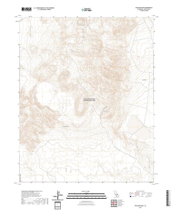
2021 Map of Volcano Peak
USGS Topo · Published 2021About this map
Volcano Peak rises as a prominent landmark within this arid Inyo County landscape, situated at the convergence of several distinct desert basins. The map illustrates the topographic transition between Rose Valley to the northwest and the Coso Basin to the east, where the seasonal drainage of Coso Wash carves through the terrain. To the south, the survey captures the northern reaches of the Mojave Desert and the Indian Wells Valley, providing a detailed look at the public land survey system divisions across these varied elevations. The scarcity of established infrastructure is notable, with Cinder Rd providing one of the few named access points into this high-desert environment, allowing researchers to trace the natural boundaries of the White Hills and surrounding geologic features as they were documented in 2021.
Find a feature on this map
14 named features on this map. Tap any name to fly to it.
Don’t see what you’re looking for? This feature index may not catch every label — zoom into the map to look around manually.
Map Details
Editions of this 2021 Volcano Peak Map
This is the sole edition of this map. No revisions or reprints were ever made.
Other maps of this area

1908 · Ballarat
USGS Topo · 1:250,000

1913 · Ballarat
USGS Topo · 1:250,000

1915 · Searles Lake
USGS Topo · 1:250,000

1947 · Trona
USGS Topo · 1:250,000

1948 · Trona
USGS Topo · 1:250,000

1948 · Death Valley
USGS Topo · 1:250,000

1951 · Haiwee Reservoir
USGS Topo · 1:62,500

1951 · Coso Peak
USGS Topo · 1:62,500

1953 · Mountain Springs Canyon
USGS Topo · 1:62,500

1953 · Trona
USGS Topo · 1:250,000