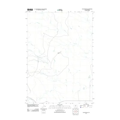
2012 Map of Volunteer SE
USGS Topo · Published 2012About this map
Englishman Butte rises as a prominent landmark in this open Meade County landscape, where the drainage systems of the western plains define the local geography. The southern edge of the map is bordered by the Belle Fourche River, a vital water source in this arid region of South Dakota. Several tributary systems, including Eightmile Cr, Fourmile Cr, and W Elm Cr, carve through the terrain, illustrating the natural watershed patterns before they join the larger river system. A sparse network of local roads like Hickory Pl and Juniper Pl provides access to the interior, reflecting a contemporary era of rural land use where the physical topography remains the dominant feature of the environment.
Find a feature on this map
8 named features on this map. Tap any name to fly to it.
Don’t see what you’re looking for? This feature index may not catch every label — zoom into the map to look around manually.
Map Details
Editions of this 2012 Volunteer SE Map
This is the sole edition of this map. No revisions or reprints were ever made.
Other maps of this area

1893 · Rapid
USGS Topo · 1:125,000

1898 · Rapid
USGS Topo · 1:125,000

1903 · Rapid
USGS Topo · 1:125,000

1913 · Newell
USGS Topo · 1:125,000

1951 · Volunteer
USGS Topo · 1:24,000

1951 · Volunteer SE
USGS Topo · 1:24,000

1953 · Rapid City 1 NW
USGS Topo · 1:24,000

1953 · Hereford
USGS Topo · 1:24,000

1953 · Rapid City 1 NE
USGS Topo · 1:24,000

1953 · Rapid City
USGS Topo · 1:250,000