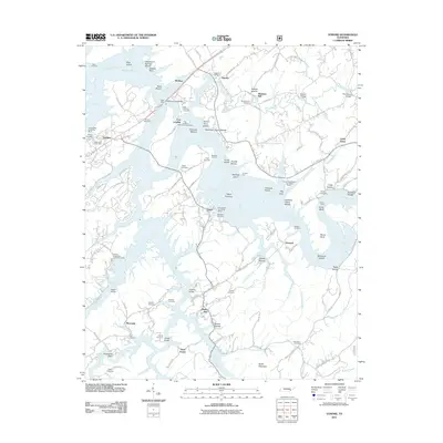
2011 Map of Vonore
USGS Topo · Published 2011About this map
Tellico Lake and the winding Little Tennessee River dominate this landscape, reflecting the significant geographic shifts brought by the Tennessee Valley Authority’s water management systems. The area around Vonore is rich with early Tennessee history, most notably the site of Fort Loudon, which stood near the confluence with the Tellico River. The map reveals a dense concentration of family and community burial grounds, such as the Niles Ferry Cemetery and Hardin Cemetery, which serve as vital markers for genealogists tracing the early settlers of Loudon County.
Find a feature on this map
128 named features on this map. Tap any name to fly to it.
Don’t see what you’re looking for? This feature index may not catch every label — zoom into the map to look around manually.
Map Details
Editions of this 2011 Vonore Map
This is the sole edition of this map. No revisions or reprints were ever made.
Other maps of this area

1893 · Murphy
USGS Topo · 1:125,000

1895 · Loudon
USGS Topo · 1:125,000

1914 · Murphy
USGS Topo · 1:125,000

1933 · Haw Knob
USGS Topo · 1:48,000

1933 · Whiteoak Flats
USGS Topo · 1:24,000

1933 · Rafter
USGS Topo · 1:24,000

1934 · Mount Vernon
USGS Topo · 1:24,000

1935 · Binfield
USGS Topo · 1:24,000

1935 · Tellico
USGS Topo · 1:48,000

1935 · Meadow
USGS Topo · 1:24,000