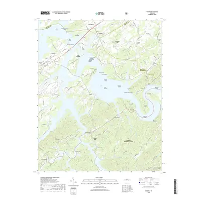
2019 Map of Vonore
USGS Topo · Published 2019About this map
Tellico Lake dominates the center of this landscape, its waters surrounding several significant islands and submerged landforms such as Foute Island and McGhee Island. The map documents a complex shoreline where the reservoir meets the foothills of the Cherokee National Forest, preserving the names of old bottomlands like Icehouse Bottom and Toqua Bottoms. This intersection of water and history is anchored by Fort Loudon, a site of colonial-era significance situated near the confluence of the river and major roads like Hwy 411.
Find a feature on this map
159 named features on this map. Tap any name to fly to it.
Don’t see what you’re looking for? This feature index may not catch every label — zoom into the map to look around manually.
Map Details
Editions of this 2019 Vonore Map
This is the sole edition of this map. No revisions or reprints were ever made.
Other maps of this area

1893 · Murphy
USGS Topo · 1:125,000

1895 · Loudon
USGS Topo · 1:125,000

1914 · Murphy
USGS Topo · 1:125,000

1933 · Haw Knob
USGS Topo · 1:48,000

1933 · Whiteoak Flats
USGS Topo · 1:24,000

1933 · Rafter
USGS Topo · 1:24,000

1934 · Mount Vernon
USGS Topo · 1:24,000

1935 · Binfield
USGS Topo · 1:24,000

1935 · Tellico
USGS Topo · 1:48,000

1935 · Meadow
USGS Topo · 1:24,000