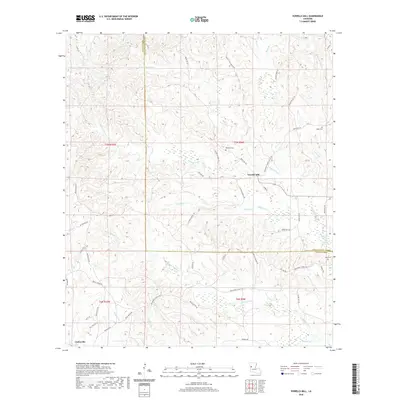
2020 Map of Vowells Mill
USGS Topo · Published 2020About this map
Vowells Mill and the surrounding timberlands define this section of the Louisiana backcountry along the border of Natchitoches Parish and Sabine Parish. The landscape is dominated by a complex network of waterways, including Bayou Chori and Bayou Santabarb, which dictate the winding paths of rural routes like Provencal Vowell Mills Rd. For those tracing local history, several small burial grounds such as Cedar Cem, Red Rock Cem, and Moss Cem are recorded, offering critical anchor points for genealogical research in this sparsely populated area. The southern portion of the quadrangle near Corleyville shows a transition into the drainage basin of Little Middle Cr, where names like Bellwood Church Rd and Whtley School Rd suggest former community centers that once served the rural families of the region.
Find a feature on this map
64 named features on this map. Tap any name to fly to it.
Don’t see what you’re looking for? This feature index may not catch every label — zoom into the map to look around manually.
Map Details
Editions of this 2020 Vowells Mill Map
This is the sole edition of this map. No revisions or reprints were ever made.
Other maps of this area

1935 · Hagewood
USGS Topo · 1:31,680

1937 · Bellwood
USGS Topo · 1:31,680

1942 · Many
USGS Topo · 1:62,500

1942 · Florien
USGS Topo · 1:62,500

1942 · Kisatchie
USGS Topo · 1:62,500

1943 · Many
USGS Topo · 1:62,500

1943 · Kisatchie
USGS Topo · 1:62,500

1943 · Provencal
USGS Topo · 1:62,500

1944 · Florien
USGS Topo · 1:62,500

1945 · Provencal
USGS Topo · 1:62,500