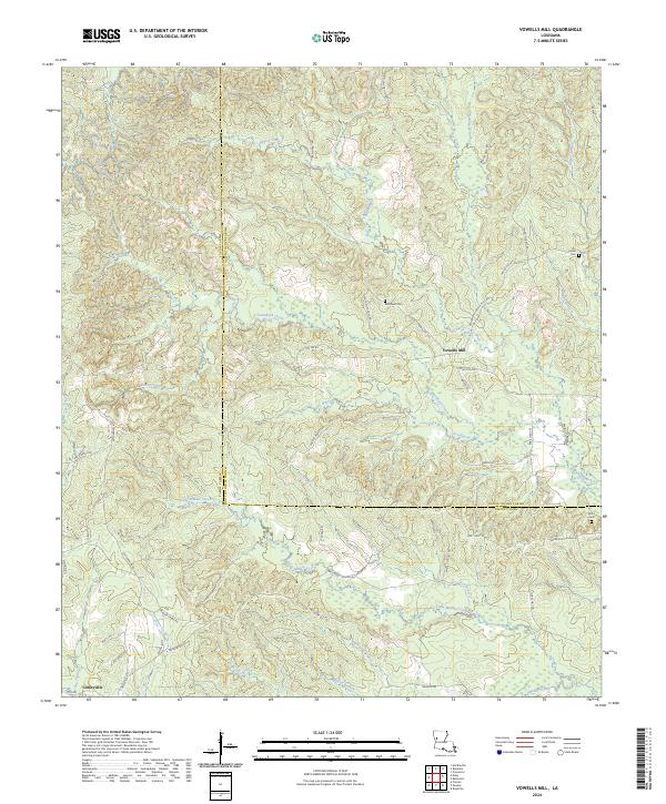
2024 Map of Vowells Mill
USGS Topo · Published 2024About this map
Vowells Mill and the surrounding piney woods of the Louisiana borderlands appear here in high detail, straddling the boundary between Sabine Parish and Natchitoches Parish. The landscape is defined by a dense network of winding bayous and branches, including Bayou Chori, Blackland Branch, and Little Middle Creek. These waterways dictate the local geography, carving through the terrain where small settlements like Corleyville and rural homesteads are connected by a web of local routes such as Provincal Vowell Mills Rd and Big Hill Fire Tower Rd.
Find a feature on this map
67 named features on this map. Tap any name to fly to it.
Don’t see what you’re looking for? This feature index may not catch every label — zoom into the map to look around manually.
Map Details
Editions of this 2024 Vowells Mill Map
This is the sole edition of this map. No revisions or reprints were ever made.
Other maps of this area

1935 · Hagewood
USGS Topo · 1:31,680

1937 · Bellwood
USGS Topo · 1:31,680

1942 · Many
USGS Topo · 1:62,500

1942 · Florien
USGS Topo · 1:62,500

1942 · Kisatchie
USGS Topo · 1:62,500

1943 · Many
USGS Topo · 1:62,500

1943 · Kisatchie
USGS Topo · 1:62,500

1943 · Provencal
USGS Topo · 1:62,500

1944 · Florien
USGS Topo · 1:62,500

1945 · Provencal
USGS Topo · 1:62,500