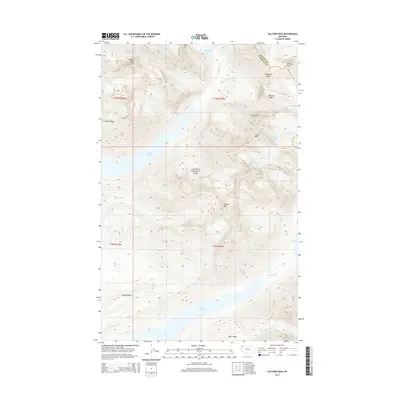
2014 Map of Vulture Peak
USGS Topo · Published 2014About this map
Vulture Peak stands as the centerpiece of this high-elevation landscape within Glacier National Park, where the Livingston Range defines a dramatic alpine environment. The map captures the presence of multiple active ice masses, including Rainbow Glacier, Vulture Glacier, and Two Ocean Glacier, illustrating the hydrologic headwaters of the region. These glaciers feed into several significant water bodies such as Cerulean Lake, Quartz Lake, and the expansive Logging Lake to the south. The terrain is marked by sharp vertical reliefs like Carnelian Cliff and prominent summits including Bighorn Peak and Logging Mtn. The boundary between Glacier and Flathead counties follows the heights of the range, showing how the natural topography has historically dictated the political borders of the Montana backcountry.
Find a feature on this map
30 named features on this map. Tap any name to fly to it.
Don’t see what you’re looking for? This feature index may not catch every label — zoom into the map to look around manually.
Map Details
Editions of this 2014 Vulture Peak Map
This is the sole edition of this map. No revisions or reprints were ever made.
Other maps of this area

1904 · Chief Mountain
USGS Topo · 1:125,000

1906 · Kintla Lakes
USGS Topo · 1:125,000

1938 · Chief Mountain
USGS Topo · 1:125,000

1938 · Kintla Lakes
USGS Topo · 1:125,000

1957 · Kalispell
USGS Topo · 1:250,000

1960 · Kalispell
USGS Topo · 1:250,000

1960 · Cut Bank
USGS Topo · 1:250,000

1961 · Kalispell
USGS Topo · 1:250,000

1963 · Cut Bank
USGS Topo · 1:250,000

1964 · Cut Bank
USGS Topo · 1:250,000