
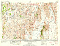
1958 Map of Vya
USGS Topo · Published 1958About this map
Sheldon National Antelope Refuge dominates the high desert landscape of northwest Nevada in this mid-century survey. The terrain is a complex arrangement of dry basins and volcanic ranges, including the Black Rock Range and Calico Mountains. Remote ranches such as the Last Chance Ranch and Drown Ranch are scattered across the Long Valley, reflecting the area's long-standing reliance on livestock and spring water sources like Indian Spring.
Find a feature on this map
104 named features on this map. Tap any name to fly to it.
Don’t see what you’re looking for? This feature index may not catch every label — zoom into the map to look around manually.
Map Details
Editions of this 1958 Vya Map
2 editions found
Other maps of this area

1882 · Paradise
USGS Topo · 1:250,000

1886 · Alturas
USGS Topo · 1:250,000

1886 · Honey Lake
USGS Topo · 1:250,000

1886 · Disaster
USGS Topo · 1:250,000

1886 · Granite Range
USGS Topo · 1:250,000

1889 · Long Valley
USGS Topo · 1:250,000

1891 · Honey Lake
USGS Topo · 1:250,000

1892 · Alturas
USGS Topo · 1:250,000

1893 · Paradise
USGS Topo · 1:250,000

1893 · Honey Lake
USGS Topo · 1:250,000