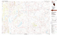
1987 Map of Vya
USGS Topo · Published 1987About this map
Sheldon National Wildlife Refuge dominates this high-desert landscape in the late 1980s, spanning the borderlands where Nevada meets Oregon and California. The remote settlement of Vya serves as a lone waypoint in Long Valley, a massive north-south depression defined by ephemeral water bodies such as Alkali Lake and Middle Lake. To the east, the terrain rises toward the Black Rock Range and the Summit Lake Indian Reservation, revealing a complex geological history through features like Bitner Butte and the Ghost Hills.
Find a feature on this map
93 named features on this map. Tap any name to fly to it.
Don’t see what you’re looking for? This feature index may not catch every label — zoom into the map to look around manually.
Map Details
Editions of this 1987 Vya Map
2 editions found
Other maps of this area

1886 · Alturas
USGS Topo · 1:250,000

1886 · Disaster
USGS Topo · 1:250,000

1889 · Long Valley
USGS Topo · 1:250,000

1892 · Alturas
USGS Topo · 1:250,000

1893 · Disaster
USGS Topo · 1:250,000

1954 · Vya
USGS Topo · 1:250,000

1954 · Alturas
USGS Topo · 1:250,000

1955 · Klamath Falls
USGS Topo · 1:250,000

1955 · Adel
USGS Topo · 1:250,000

1957 · Adel
USGS Topo · 1:250,000