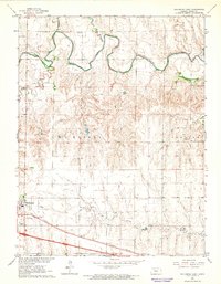
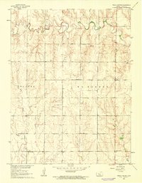
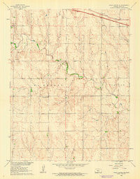
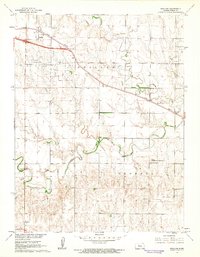
1962 Map of Wa Keeney East
USGS Topo · Published 1964About this map
The Saline River winds through the northern landscape of this Trego County study, carving a valley fed by tributaries like Happy Chalk Creek and Trego Creek. This 1962 field check reveals a community centered on the transit and extraction economies of western Kansas, where the Union Pacific railroad and major highways intersect at Wakeeney. The town layout includes essential civic landmarks such as the WaKeeney Cem and the local Fairground, while the presence of a Drive-in Theater and several Oil Wells scattered across the uplands speaks to the mid-century social and industrial character of the region. Natural drainage patterns are clearly defined by Spring Creek and Shaw Creek, illustrating the transition from the river bottomlands to the higher plains of Ogallah and Wakeeney townships.
Find a feature on this map
26 named features on this map. Tap any name to fly to it.
Don’t see what you’re looking for? This feature index may not catch every label — zoom into the map to look around manually.
Map Details
Editions of this 1962 Wa Keeney East Map
This is the sole edition of this map. No revisions or reprints were ever made.
Other maps of this area

1893 · Ellis
USGS Topo · 1:125,000

1893 · Hill
USGS Topo · 1:125,000

1955 · Great Bend
USGS Topo · 1:250,000

1955 · Beloit
USGS Topo · 1:250,000

1957 · Great Bend
USGS Topo · 1:250,000

1958 · Great Bend
USGS Topo · 1:250,000

1959 · Beloit
USGS Topo · 1:250,000
1960 · Trego Center
USGS Topo · 1:24,000
1960 · Trego Center NE
USGS Topo · 1:24,000
1961 · Ogallah
USGS Topo · 1:24,000