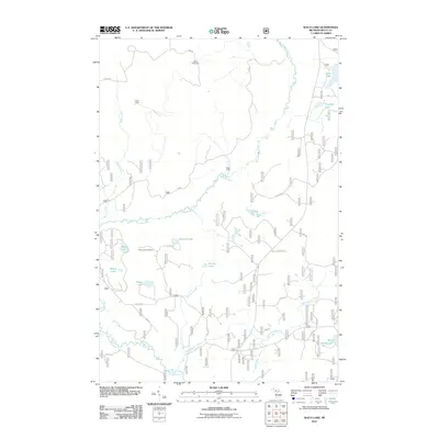
2011 Map of Waco Lake
USGS Topo · Published 2011About this map
The Sturgeon River meanders through this heavily forested portion of Delta County, defining a landscape shaped by logging history and backcountry water systems. Remnants of the region's timber heritage are visible in named sites such as Camp Twentysix, Lakes Camp, and Palos Camp, which are connected by an intricate network of forest roads like Nat For Dev Rd 13. The topography is dominated by a dense collection of small glacial lakes, including Waco Lake, Narbon Lake, and Kenobo Lake.
Find a feature on this map
32 named features on this map. Tap any name to fly to it.
Don’t see what you’re looking for? This feature index may not catch every label — zoom into the map to look around manually.
Map Details
Editions of this 2011 Waco Lake Map
This is the sole edition of this map. No revisions or reprints were ever made.
Other maps of this area

1931 · Skeels Lake NE
USGS Topo · 1:31,680

1932 · Rapid River NE
USGS Topo · 1:31,680

1932 · Garden NW and SW
USGS Topo · 1:31,680

1932 · Skeels Lake SE
USGS Topo · 1:31,680

1932 · Trenary SE
USGS Topo · 1:31,680

1932 · Skeels Lake NW and SW
USGS Topo · 1:31,680

1932 · Garden NE
USGS Topo · 1:31,680

1954 · Escanaba
USGS Topo · 1:250,000

1957 · Escanaba
USGS Topo · 1:250,000

1958 · Escanaba
USGS Topo · 1:250,000