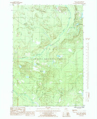
1985 Map of Waco Lake
USGS Topo · Published 1985About this map
The Sturgeon River flows through this corner of the Hiawatha National Forest, a landscape defined by its glacial history and logging legacy. In the mid-1980s, the area remained a remote network of seasonal camps and specialized transit routes. Former logging infrastructure is evident in the presence of the Old RR Grade and the Nahma Grade, which underscore the historic timber economy of Delta County.
Find a feature on this map
24 named features on this map. Tap any name to fly to it.
Don’t see what you’re looking for? This feature index may not catch every label — zoom into the map to look around manually.
Map Details
Editions of this 1985 Waco Lake Map
This is the sole edition of this map. No revisions or reprints were ever made.
Other maps of this area

1931 · Skeels Lake NE
USGS Topo · 1:31,680

1932 · Rapid River NE
USGS Topo · 1:31,680

1932 · Garden NW and SW
USGS Topo · 1:31,680

1932 · Skeels Lake SE
USGS Topo · 1:31,680

1932 · Trenary SE
USGS Topo · 1:31,680

1932 · Skeels Lake NW and SW
USGS Topo · 1:31,680

1932 · Garden NE
USGS Topo · 1:31,680

1954 · Escanaba
USGS Topo · 1:250,000

1957 · Escanaba
USGS Topo · 1:250,000

1958 · Escanaba
USGS Topo · 1:250,000