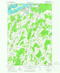
1964 Map of Waddington
USGS Topo · Published 1966About this map
Waddington and the international boundary along the St Lawrence River define this mid-1960s landscape, just years after the massive Seaway projects transformed the northern shoreline. The map documents the newly created Lake St Lawrence and Ogden Island, with local recreation centered at Waddington Beach. Moving inland from the river, the area transitions into a network of small agricultural settlements and rural intersections named for early families, including Henrys Corners, Drews Corner, and Wagners Corners. Local history and genealogy are preserved through several sites such as Brookside Cem and St Marys Ch. The interior is drained by meandering waterways like Sucker Brook and Brandy Brook, while the southern portion of the quadrangle reaches the village of Madrid along the Grass River, featuring the Madrid-Waddington High Sch.
Find a feature on this map
63 named features on this map. Tap any name to fly to it.
Don’t see what you’re looking for? This feature index may not catch every label — zoom into the map to look around manually.
Map Details
Editions of this 1964 Waddington Map
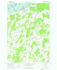
2 editions found
Other maps of this area

1904 · Lisbon
USGS Topo · 1:48,000

1904 · Ogdensburg
USGS Topo · 1:62,500

1905 · Waddington
USGS Topo · 1:62,500

1905 · Ogdensburg
USGS Topo · 1:62,500

1906 · Red Mills
USGS Topo · 1:62,500

1910 · Canton
USGS Topo · 1:62,500

1911 · Canton
USGS Topo · 1:62,500

1942 · Waddington
USGS Topo · 1:24,000

1942 · Chase Mills
USGS Topo · 1:24,000

1942 · Murphy Island
USGS Topo · 1:24,000