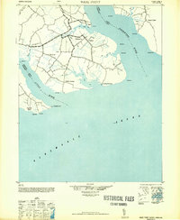
1948 Map of Wade Point
USGS Topo · Published 1948About this map
Albemarle Sound dominates the southern landscape of this 1948 military edition map, where the peninsula formed by the Pasquotank River and the Little River meets the open water. The interior reveals a quiet agricultural and coastal community centered around Weeksville, Winslow, and Salem. This era shows a distinctive blend of traditional maritime life and mid-century military infrastructure, highlighted by the prominent Air Base near New Begun Creek. A network of small waterways, including Big Flatty Creek and Little Flatty Creek, carves into the shoreline, creating a fragmented coast of named points like Wade Point and Poquoson Point. Local leisure and commerce are evident at the Frog Island Fishing Club and the crossroads at Listers Corner, while Pear Tree Road serves as a primary artery connecting these isolated rural settlements to the broader Pasquotank County region.
Find a feature on this map
36 named features on this map. Tap any name to fly to it.
Don’t see what you’re looking for? This feature index may not catch every label — zoom into the map to look around manually.
Map Details
Editions of this 1948 Wade Point Map
2 editions found

Other maps of this area

1906 · Hertford
USGS Topo · 1:62,500

1940 · Barco
USGS Topo · 1:62,500

1940 · Hertford
USGS Topo · 1:62,500

1940 · Powells Point
USGS Topo · 1:62,500

1940 · Wade Point
USGS Topo · 1:62,500

1940 · South Mills
USGS Topo · 1:62,500

1943 · Wade Point
USGS Topo · 1:62,500

1943 · Columbia
USGS Topo · 1:125,000

1943 · Roanoke Island
USGS Topo · 1:125,000

1946 · Eastville
USGS Topo · 1:250,000