
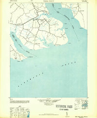
1948 Map of Wade Point
USGS Topo · Published 1948About this map
The coastal peninsula of Pasquotank County is defined here by the confluence of the Pasquotank River and the Little River as they enter the Albemarle Sound. This postwar survey captures a landscape of low-lying marshlands and agricultural settlements, where the local economy was anchored by the water. Coastal sites like the Frog Island Fishing Club and several named points such as Wade Point and Poquoson Point highlight the importance of the sound and its tributaries.
Find a feature on this map
35 named features on this map. Tap any name to fly to it.
Don’t see what you’re looking for? This feature index may not catch every label — zoom into the map to look around manually.
Map Details
Editions of this 1948 Wade Point Map
2 editions found
Other maps of this area

1906 · Hertford
USGS Topo · 1:62,500

1940 · Barco
USGS Topo · 1:62,500

1940 · Hertford
USGS Topo · 1:62,500

1940 · Powells Point
USGS Topo · 1:62,500

1940 · Wade Point
USGS Topo · 1:62,500

1940 · South Mills
USGS Topo · 1:62,500

1943 · Wade Point
USGS Topo · 1:62,500

1943 · Columbia
USGS Topo · 1:125,000

1943 · Roanoke Island
USGS Topo · 1:125,000

1946 · Eastville
USGS Topo · 1:250,000