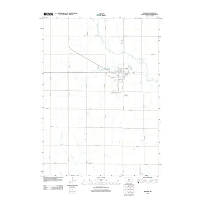
2012 Map of Wagner
USGS Topo · Published 2012About this map
Wagner serves as the central hub of this South Dakota landscape, established along a grid of residential streets such as N St NE and Front St. The town's layout is defined by the proximity of Lake Wagner to the north and the expansive facilities of the Wagner Municipal Airport to the south. This 2012 survey illustrates the intersection of rural agriculture and municipal development, with the town buffered by the winding course of Choteau Cr.
Find a feature on this map
39 named features on this map. Tap any name to fly to it.
Don’t see what you’re looking for? This feature index may not catch every label — zoom into the map to look around manually.
Map Details
Editions of this 2012 Wagner Map
This is the sole edition of this map. No revisions or reprints were ever made.
Other maps of this area

1955 · Mitchell
USGS Topo · 1:250,000

1955 · O'Neill
USGS Topo · 1:250,000

1959 · O'Neill
USGS Topo · 1:250,000

1959 · Mitchell
USGS Topo · 1:250,000

1964 · Wagner NE
USGS Topo · 1:24,000

1964 · Ravinia
USGS Topo · 1:24,000

1964 · Wagner
USGS Topo · 1:24,000

1964 · Lynch NE
USGS Topo · 1:24,000

1964 · Wagner SW
USGS Topo · 1:24,000
1964 · Marty
USGS Topo · 1:24,000