
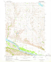
1964 Map of Lynch NE
USGS Topo · Published 1966About this map
The Missouri River forms the southern boundary of this South Dakota landscape, where the South Dakota Nebraska state line follows the river's winding course. The area is defined by the legacy of the Old Indian Treaty Boundary, which cuts across the terrain near Song Hawk Lake. This mid-century survey documents a rural landscape organized by a network of numbered school districts, including School No 80 and School No 61, reflecting the localized education system of the time. Local spiritual life is anchored by the Native American Ch near the center of the sheet.
Find a feature on this map
25 named features on this map. Tap any name to fly to it.
Don’t see what you’re looking for? This feature index may not catch every label — zoom into the map to look around manually.
Map Details
Editions of this 1964 Lynch NE Map
2 editions found
Other maps of this area

1950 · Verdel
USGS Topo · 1:24,000

1950 · Lynch
USGS Topo · 1:24,000

1950 · Monowi
USGS Topo · 1:24,000

1952 · Monowi
USGS Topo · 1:24,000

1955 · Mitchell
USGS Topo · 1:250,000

1955 · O'Neill
USGS Topo · 1:250,000

1959 · O'Neill
USGS Topo · 1:250,000

1959 · Mitchell
USGS Topo · 1:250,000

1964 · Wagner
USGS Topo · 1:24,000

1964 · Wagner SW
USGS Topo · 1:24,000
Featured Places
- Lawrence Township, SD
- Plain Center Township, SD
- Ree Township, SD
- Wahehe Township, SD
- Charles Mix County, SD