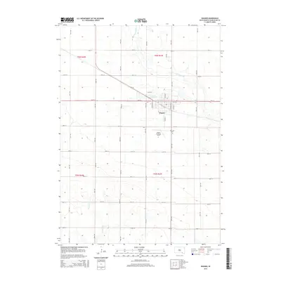
2015 Map of Wagner
USGS Topo · Published 2015About this map
Wagner serves as the primary hub for this section of Charles Mix County, centered around a traditional grid with streets such as Main Ave N and Walnut Ave SW. The town's local infrastructure is well-defined by features like Lake Wagner and the Wagner Municipal Airport, while the surrounding landscape is marked by the meandering path of Choteau Creek to the north and east. This 2015 survey illustrates a highly structured section-line road network typical of the Great Plains, where long thoroughfares like 395th Ave and 297th St divide the agricultural terrain into precise squares. For genealogists, the location of Saint Johns Cem south of the town center offers a specific point for local history research. Further south, the drainage of Slaughter Cr cuts through the sections, contrasting the engineered road grid with the natural topography of the South Dakota prairie.
Find a feature on this map
67 named features on this map. Tap any name to fly to it.
Don’t see what you’re looking for? This feature index may not catch every label — zoom into the map to look around manually.
Map Details
Editions of this 2015 Wagner Map
This is the sole edition of this map. No revisions or reprints were ever made.
Other maps of this area

1955 · Mitchell
USGS Topo · 1:250,000

1955 · O'Neill
USGS Topo · 1:250,000

1959 · O'Neill
USGS Topo · 1:250,000

1959 · Mitchell
USGS Topo · 1:250,000

1964 · Wagner NE
USGS Topo · 1:24,000

1964 · Ravinia
USGS Topo · 1:24,000

1964 · Wagner
USGS Topo · 1:24,000

1964 · Lynch NE
USGS Topo · 1:24,000

1964 · Wagner SW
USGS Topo · 1:24,000
1964 · Marty
USGS Topo · 1:24,000