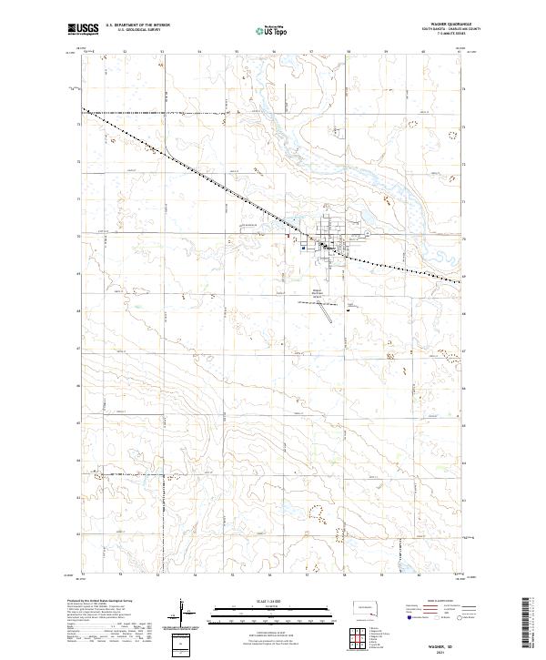
2021 Map of Wagner
USGS Topo · Published 2021About this map
The settlement of Wagner sits as the central hub of this Charles Mix County landscape, organized along a traditional grid that includes 2nd St and 5th St. This 2021 survey reveals a landscape defined by the intersection of agricultural sections and water drainage patterns, with Choteau Creek winding through the northern portion of the quadrangle. To the south, the terrain is shaped by the intermittent flow of Slaughter Cr, illustrating the typical hydrology of the South Dakota plains. Local infrastructure is represented by the Wagner Municipal Airport and the historical site of Saint Johns Cem southeast of the main town. Water features like Lake Wagner provide key landmarks within the vast stretches of section-line roads such as 295th St and 302nd St, which demarcate the rural township boundaries of t96n r63w and t95n r63w.
Find a feature on this map
23 named features on this map. Tap any name to fly to it.
Don’t see what you’re looking for? This feature index may not catch every label — zoom into the map to look around manually.
Map Details
Editions of this 2021 Wagner Map
This is the sole edition of this map. No revisions or reprints were ever made.
Other maps of this area

1955 · Mitchell
USGS Topo · 1:250,000

1955 · O'Neill
USGS Topo · 1:250,000

1959 · O'Neill
USGS Topo · 1:250,000

1959 · Mitchell
USGS Topo · 1:250,000

1964 · Wagner NE
USGS Topo · 1:24,000

1964 · Ravinia
USGS Topo · 1:24,000

1964 · Wagner
USGS Topo · 1:24,000

1964 · Lynch NE
USGS Topo · 1:24,000

1964 · Wagner SW
USGS Topo · 1:24,000
1964 · Marty
USGS Topo · 1:24,000