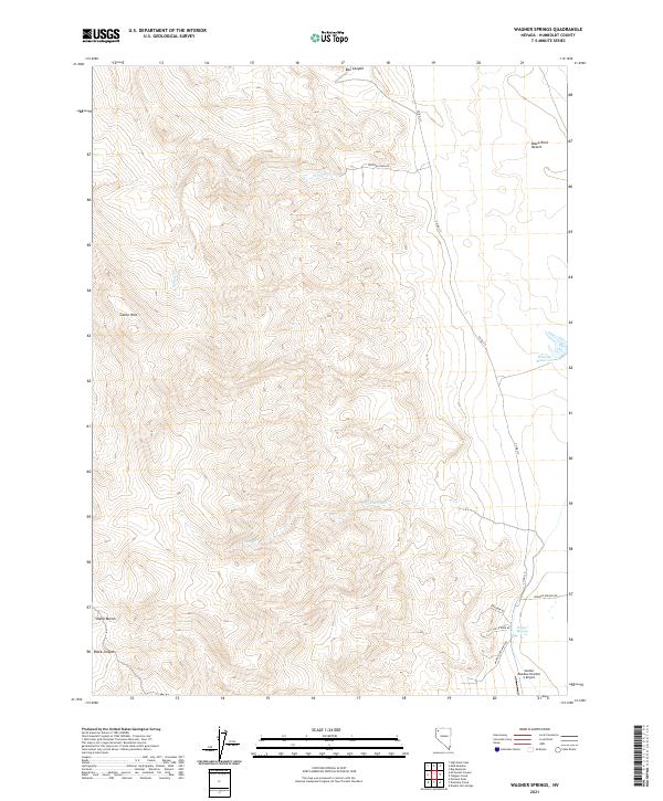
2021 Map of Wagner Springs
USGS Topo · Published 2021About this map
Wagner Springs serves as a critical water source in this corner of the Black Rock Desert, where the high desert terrain meets the eastern slopes of the Calico Hills. The landscape is defined by its remote access points and geological landmarks, including the prominent Sheep Buttes and the steep walls of Black Canyon to the west. While the area is largely unpopulated, the network of tracks such as Little Jo Mine Rd and Angela Opal Mine Rd indicates the region's enduring connection to mineral exploration and mining interests.
Find a feature on this map
22 named features on this map. Tap any name to fly to it.
Don’t see what you’re looking for? This feature index may not catch every label — zoom into the map to look around manually.
Map Details
Editions of this 2021 Wagner Springs Map
This is the sole edition of this map. No revisions or reprints were ever made.
Other maps of this area

1889 · Long Valley
USGS Topo · 1:250,000

1954 · Vya
USGS Topo · 1:250,000

1958 · Vya
USGS Topo · 1:250,000

1962 · Vya
USGS Topo · 1:250,000

1972 · Mud Meadow
USGS Topo · 1:24,000

1972 · High Rock Lake
USGS Topo · 1:24,000

1972 · Big Mountain
USGS Topo · 1:24,000
1979 · Double Hot Springs
USGS Topo · 1:24,000
1980 · Clapper Creek
USGS Topo · 1:24,000
1980 · Division Peak
USGS Topo · 1:24,000