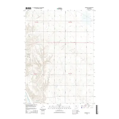
2015 Map of Wagner SW
USGS Topo · Published 2015About this map
Missouri River bluffs and rolling uplands dominate this landscape in White Swan Township. The terrain is deeply incised by drainages such as Williamson Gulch and Black Timber Gulch, which cut through the western ridges toward the river bottomlands. On the high ground, the Cedar Presbyterian Cem serves as a significant local landmark for genealogists and historians tracking early families in this part of Charles Mix County. The map details a well-defined grid of section roads, including 387th Ave and 297th St, which provide access to the various creeks and lakes that dot the area. Water features vary from the broad Red Lake in the northeast corner to the winding paths of Sevenmile Cr and Mosquito Cr. The inclusion of Chalk Rock Rd near the southern boundary highlights the local geology and the pathways used by residents to navigate the breaks and draws leading to the water's edge.
Find a feature on this map
29 named features on this map. Tap any name to fly to it.
Don’t see what you’re looking for? This feature index may not catch every label — zoom into the map to look around manually.
Map Details
Editions of this 2015 Wagner SW Map
This is the sole edition of this map. No revisions or reprints were ever made.
Other maps of this area

1955 · Mitchell
USGS Topo · 1:250,000

1955 · O'Neill
USGS Topo · 1:250,000

1959 · O'Neill
USGS Topo · 1:250,000

1959 · Mitchell
USGS Topo · 1:250,000

1964 · Wagner NE
USGS Topo · 1:24,000

1964 · Ravinia
USGS Topo · 1:24,000

1964 · Fort Randall Dam
USGS Topo · 1:24,000

1964 · Gross
USGS Topo · 1:24,000

1964 · Lake Andes
USGS Topo · 1:24,000

1964 · Wagner
USGS Topo · 1:24,000
Featured Places
- White Swan Township, SD
- Plain Center Township, SD
- Plain Center Township, SD
- Charles Mix County, SD
- Gregory County, SD