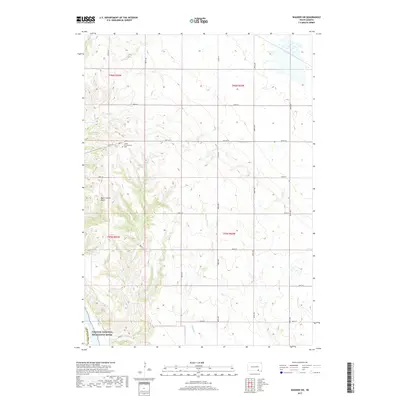
2017 Map of Wagner SW
USGS Topo · Published 2017About this map
Cedar Presbyterian Cem stands as a focal point for genealogy and local history in this portion of Charles Mix County. This landscape is defined by the drainage systems of Mosquito Cr and Sevenmile Cr, which carve through the terrain toward the southern boundary. Along the southwestern edge, the Missouri National Recreation River corridor marks a significant protected area where the river meets the rolling bluffs. The map captures a rural grid of section lines and gravel roads such as 387th Ave and 297th St, which connect isolated farmsteads and agricultural plots. To the north, the shallow waters of Red Lake provide a contrast to the deeper incisions of Black Timber Gulch, illustrating the diverse topography of the South Dakota plains.
Find a feature on this map
27 named features on this map. Tap any name to fly to it.
Don’t see what you’re looking for? This feature index may not catch every label — zoom into the map to look around manually.
Map Details
Editions of this 2017 Wagner SW Map
This is the sole edition of this map. No revisions or reprints were ever made.
Other maps of this area

1955 · Mitchell
USGS Topo · 1:250,000

1955 · O'Neill
USGS Topo · 1:250,000

1959 · O'Neill
USGS Topo · 1:250,000

1959 · Mitchell
USGS Topo · 1:250,000

1964 · Wagner NE
USGS Topo · 1:24,000

1964 · Ravinia
USGS Topo · 1:24,000

1964 · Fort Randall Dam
USGS Topo · 1:24,000

1964 · Gross
USGS Topo · 1:24,000

1964 · Lake Andes
USGS Topo · 1:24,000

1964 · Wagner
USGS Topo · 1:24,000
Featured Places
- White Swan Township, SD
- Plain Center Township, SD
- Plain Center Township, SD
- Charles Mix County, SD
- Gregory County, SD