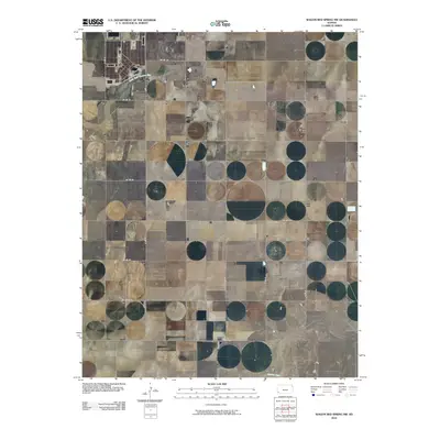
2010 Map of Wagon Bed Spring NW
USGS Topo · Published 2010About this map
The Golden Cemetery sits on a high point above the North Fork Cimarron River in this section of Grant County, Kansas. This 2010 survey reflects a landscape defined by the Jeffersonian grid, where local routes like Co Rd 18 and Co Rd 19 carve precise squares across the plains. The terrain is shaped by the subtle drainage patterns of the High Plains, with the larger Cimarron River cutting across the southeastern corner of the quadrangle. While modern infrastructure like Rd Dd and Co Rd 10 S facilitates movement through the township, the presence of the solitary cemetery suggests the deep-rooted agricultural history of the area. The map illustrates a region where land use is dictated by the availability of water, with most development clustered near the river forks or along the established county road network.
Find a feature on this map
17 named features on this map. Tap any name to fly to it.
Don’t see what you’re looking for? This feature index may not catch every label — zoom into the map to look around manually.
Map Details
Editions of this 2010 Wagon Bed Spring NW Map
This is the sole edition of this map. No revisions or reprints were ever made.
Other maps of this area

1891 · Larned
USGS Topo · 1:125,000

1900 · Syracuse
USGS Topo · 1:125,000

1900 · Lakin
USGS Topo · 1:125,000

1920 · Syracuse
USGS Topo · 1:125,000

1955 · Dodge City
USGS Topo · 1:250,000

1958 · Dodge City
USGS Topo · 1:250,000

1959 · Dodge City
USGS Topo · 1:250,000

1959 · Ulysses
USGS Topo · 1:24,000
1959 · Big Bow
USGS Topo · 1:24,000
1959 · Ulysses SW
USGS Topo · 1:24,000