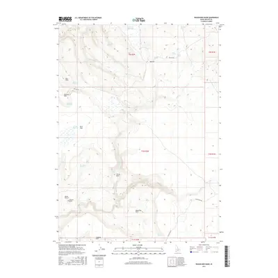
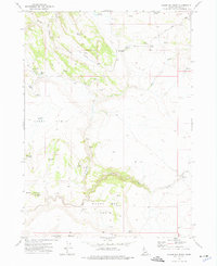
2017 Map of Wagon Box Basin
USGS Topo · Published 2017About this map
Mud Flat serves as a central landmark in this high-desert landscape of southwestern Idaho, where water sources dictate the geography of human and ranching activity. The terrain is characterized by a series of distinct basins and plateaus, including Bull Basin, Henley Basin, and the prominent Avery Table. These natural features are essential for understanding the seasonal movement of livestock and the historical management of the land. Water management is evident through several small impoundments such as Johnson Reservoir, Bennett Reservoir, and Bullhead Reservoir, which supplement the area's natural springs. Sam Noble Spring and Moonshine Spring provide reliable points for local wildlife and ranching operations. The road network is sparse, centered on the primary thoroughfares of Mud Flat Rd and Dickshooter Rd, which connect this remote Owyhee County terrain to the broader region. This 2017 survey shows a landscape that remains largely defined by its original ranching landmarks and topographic features like Spencer Butte and Camel Falls.
Find a feature on this map
35 named features on this map. Tap any name to fly to it.
Don’t see what you’re looking for? This feature index may not catch every label — zoom into the map to look around manually.
Map Details
Editions of this 2017 Wagon Box Basin Map
This is the sole edition of this map. No revisions or reprints were ever made.
Other maps of this area

1955 · Jordan Valley
USGS Topo · 1:250,000

1957 · Jordan Valley
USGS Topo · 1:250,000

1958 · Jordan Valley
USGS Topo · 1:250,000
1972 · Frying Pan Basin
USGS Topo · 1:24,000
1972 · Big Springs Ranch
USGS Topo · 1:24,000
1972 · Clover Mtn
USGS Topo · 1:24,000
1973 · Wagon Box Basin
USGS Topo · 1:24,000

1973 · Castro Table
USGS Topo · 1:24,000

1973 · Hurry Up Creek
USGS Topo · 1:24,000

1973 · Wickiup Creek
USGS Topo · 1:24,000