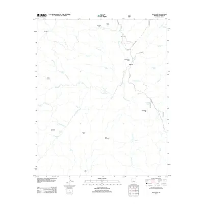
2012 Map of Wagoner
USGS Topo · Published 2012About this map
The Hassayampa River carves a path through this high-desert landscape of Yavapai County, where the settlement of Wagoner serves as a central point for the surrounding cattle operations and remote outposts. Ranching history is deeply etched into the terrain, evidenced by the Diamond Two Ranch, Minoto Ranch, and the Cooper Ranch Airport. The mapping reveals a complex network of seasonal water sources and springs, such as Moonshiner Spring, Jesus Spring, and Thousand Spring, which were vital for survival in this arid environment. Significant landmarks like Sugarloaf Mountain, Seal Mountain, and Wades Butte rise above the drainage systems of Cottonwood Cr and Blind Indian Cr. The presence of several gulches, including French Gulch and Hodgkins Gulch, alongside named canyons like Mocho Canyon, indicates the weathered topography that has shaped land use from the early ranching era through the modern day.
Find a feature on this map
41 named features on this map. Tap any name to fly to it.
Don’t see what you’re looking for? This feature index may not catch every label — zoom into the map to look around manually.
Map Details
Editions of this 2012 Wagoner Map
This is the sole edition of this map. No revisions or reprints were ever made.
Other maps of this area

1887 · Prescott
USGS Topo · 1:250,000

1892 · Prescott
USGS Topo · 1:250,000

1903 · Bradshaw Mountains
USGS Topo · 1:125,000

1903 · Congress
USGS Topo · 1:125,000

1904 · Congress
USGS Topo · 1:125,000

1947 · Crown King
USGS Topo · 1:62,500

1947 · Mt. Union
USGS Topo · 1:62,500

1947 · Kirkland
USGS Topo · 1:62,500

1947 · Wagoner
USGS Topo · 1:62,500

1948 · Crown King
USGS Topo · 1:63,360