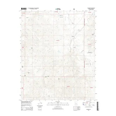
2014 Map of Wagoner
USGS Topo · Published 2014About this map
Wagoner and the surrounding high desert of Yavapai County are defined by a complex network of seasonal drainages and spring-fed canyons. The Hassayampa River serves as the primary longitudinal corridor, joined by numerous tributaries such as Arrastre Cr and Blind Indian Cr. This drainage system supported early industry in the region, evidenced by the Smith Bros Mines located east of the river. The topography is varied and dramatic, transitioning from the broad expanse of The Park in the northwest to the prominent heights of Sugarloaf Mtn and Seal Mtn. Within the Prescott National Forest, family-named landmarks like the McAllister Range and Campbells Flat speak to the area's history of ranching and remote settlement. Unique geological depressions and formations such as The Hole and Wades Butte further characterize this portion of the Arizona interior.
Find a feature on this map
51 named features on this map. Tap any name to fly to it.
Don’t see what you’re looking for? This feature index may not catch every label — zoom into the map to look around manually.
Map Details
Editions of this 2014 Wagoner Map
This is the sole edition of this map. No revisions or reprints were ever made.
Other maps of this area

1887 · Prescott
USGS Topo · 1:250,000

1892 · Prescott
USGS Topo · 1:250,000

1903 · Bradshaw Mountains
USGS Topo · 1:125,000

1903 · Congress
USGS Topo · 1:125,000

1904 · Congress
USGS Topo · 1:125,000

1947 · Crown King
USGS Topo · 1:62,500

1947 · Mt. Union
USGS Topo · 1:62,500

1947 · Kirkland
USGS Topo · 1:62,500

1947 · Wagoner
USGS Topo · 1:62,500

1948 · Crown King
USGS Topo · 1:63,360